Showing posts with label Jammu and Kashmir. Show all posts

27 March, 2014

Turtuk - Delightful Baltistan Indian frontier village


The barren landscape slowly transformed to green pastures. The chortens and prayer flags, those ubiquitous landmarks of Ladakh, had disappeared. The village transformed from Buddhist-Ladhaki to Muslim-Balti both culturally and linguistically as we drove from Hunder via Panamik to Turtuk, a delightful hamlet tucked into a narrow Shyok river valley in the farthest corner of India. It is literally the last village on Indian Line of border control.


The scenically magnificent main village is up a steep stairway leading to stone terracing. High on a crag are the crumbling ruins of an old fort. Turtuk like any other typical Baltistan village perches on laboriously terraced and fertilised alluvial fans that extend from side streams onto the banks of the main rivers. It is a tight cluster of interconnected houses and narrow passageways. Houses of stone and dried mud-brick with flat roofs of interlaced willow fronds overlain with mud stand in the shade of giant apricot, walnut and mulberry trees. As with other Ladakhi/Balti villages, water channels gurgle through the winding village lanes.


River Shyok (literally "the river of death" in Yarkandi or Central Asian - probably given by the Central Asian traders who ventured on this treacherous route for centuries and perished) a roaring, turquoise torrent rushing to converge with the mighty Indus in Pakistan is the only thing noisy and brash in an otherwise tranquil and peaceful podunk. Its water is augmented perennially by the countless little streams originating from the Himalayan glaciers. One such gushing glacier-stream cuts across Turtuk, dividing the village into two sides known as the Youl and Farol. Youl, the original Turtuk village, is clustered below the old fort and palace on the west bank of the stream. Pharol is the newer village area among terraced fields on the east bank of the stream. About 300+ Balti families belonging to Tibetan origin stay happily together on either sides.


In the Balti language, balti refers to a basement chamber where animals are housed below the ground-level human dwelling space. Such protective housing for a necessarily limited number of animals marks the early Balti people as settled agriculturists. These Tibetan-speaking farmers might have been known to their Tibetan pastoral neighbors as Balti-pa, "those who keep their animals in an underground chamber"

In winter the families occupy an 8X10 feet ground floor room with their animals quartered below in the balti. In summer much of the life and work of the household takes place on the roof. The village occupies as little space as possible in order to allow maximum amount of cultivation in this inhospitable soil. The village is surrounded by small plots of privately owned land. Although new lands are developed through communally pooled labour, as the land comes into production it is divided into individually owned parcels, and villages must travel farther and farther away from the village to work their fields. The people continue to reside in the main village, preserving its compact character.


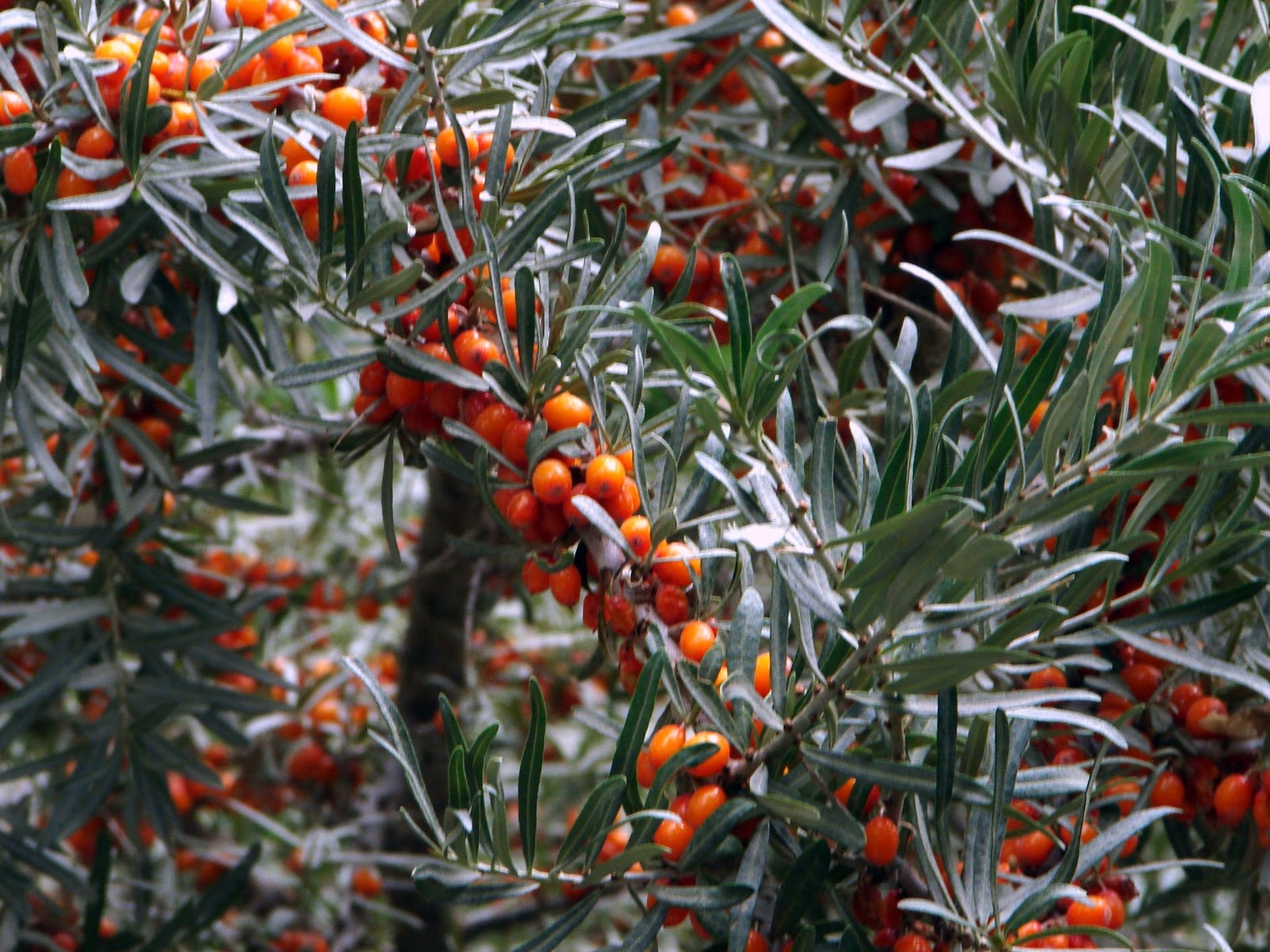
Being lower in altitude than most towns in Nubra Valley (somewhere around 3000m), the village is fertile and lush with vegetation. Agriculture is in its full splendour during the summer months. Vegetables including cauliflower, tomato, cabbage, spinach, carrots and greens are cultivated and stored for the long and hard winter. Apricot trees border every house's fencing. Walnut trees sport green, unripe fruits. The locals dry up the mature fruits to extract the crispy walnuts. Ancient Chinese documents refer to Baltistan as 'Apricot Tibet' and Balti dried apricots were prized as far east as Lhasa.




The Balti, presumably descendants of the Scythians (Saka), form a majority group among the Muslims of Ladakh in Jammu and Kashmir. They derive their name from their homeland Baltistan, and they also perceive their distribution in Kargil, Leh and in parts of Baltistan. They speak Balti and use the Perso-Arabic script.


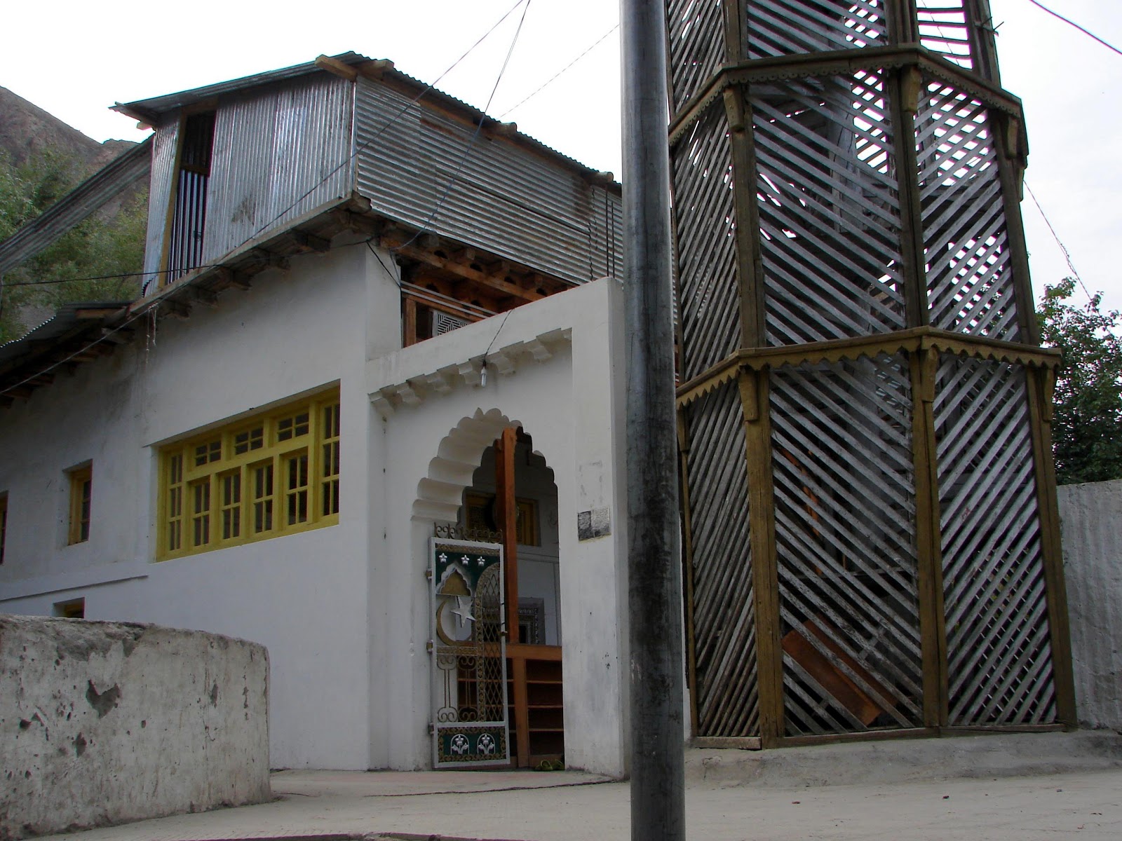
The Baltis were Buddhist prior to 1400. At approximately that time, Sufi teachers converted the Baltis to Islam. Local tradition attributes the origin of Islam in Baltistan to one or more visits from Kashmir by Sayyid 'Ali al' Hamadani. There is no historical record of his personal visit, but his influence, whether directly or through his disciples, is well established. Some of the oldest mosques in Baltistan are wooden Khanaqahs, constructed on the unique design of the famous Shah Hamadan mosque in Srinagar.

But most interesting, the Nurbakshiya Sufi order, derived from Ali al Hamadani through Isaq al Khuttalani to Muhammad ibn Abdullah (known as Nurbaksh) was brought from Kashmir to Baltistan. Nurbakshiya Sufis still prevail in the eastern sections of Baltistan and are numerous in the Shigar region. The rest of the Balti population, notably in the Skardu area is predominantly Shia.


Following information has been borrowed from Encyclopaedia of the World Muslims: Tribes, Castes and Communities, Volume 1

A more important social-organisational correlate of Balti hydraulic ecology is seen in the history of state formation and alien rule in Baltistan. What are now the three most intensively irrigated regional centres in Baltistan - Skardu, Shigar and Khapalu - were, from as early as 740 A.D., the foci of major political development in the upper Indus Basin. Most likely under the sponsorship of Chinese imperial power in Turkestani dynasties established rulership in all three regions of Baltistan. The Amacha family ruled over the sovereign state of Shigar from some unknown date of origin until 1840.

The Yabgo dynasty was ruling in Khapalu for some time well before 1500 until 1972, when Khapalu was fully annexed into Pakistan. There is a reason to believe that 'Amacha' derives from Amacas, a title granted by the Chinese crown to the kings of Khota; and the 'Yabgo' derives from yabghu, the title of the 8th C Turkic Buddhist rulers of Kundus in the Tokharistan region of Turkestan.


In Baltistan, these dynasties came to rule under the title cho ('chief' in Balti/Tibetan). Thus a ruling class of ancient Turkestan origin (called Kha-Cho, brothers of the Cho) ruled over indigenous Tibetan-speaking cultivators. The Balti states lost sovereigenity and were gradually absorbed into the British-Indian empire beginning in 1840, when Zorawar Singh conquered all of Baltistan and Ladakh.


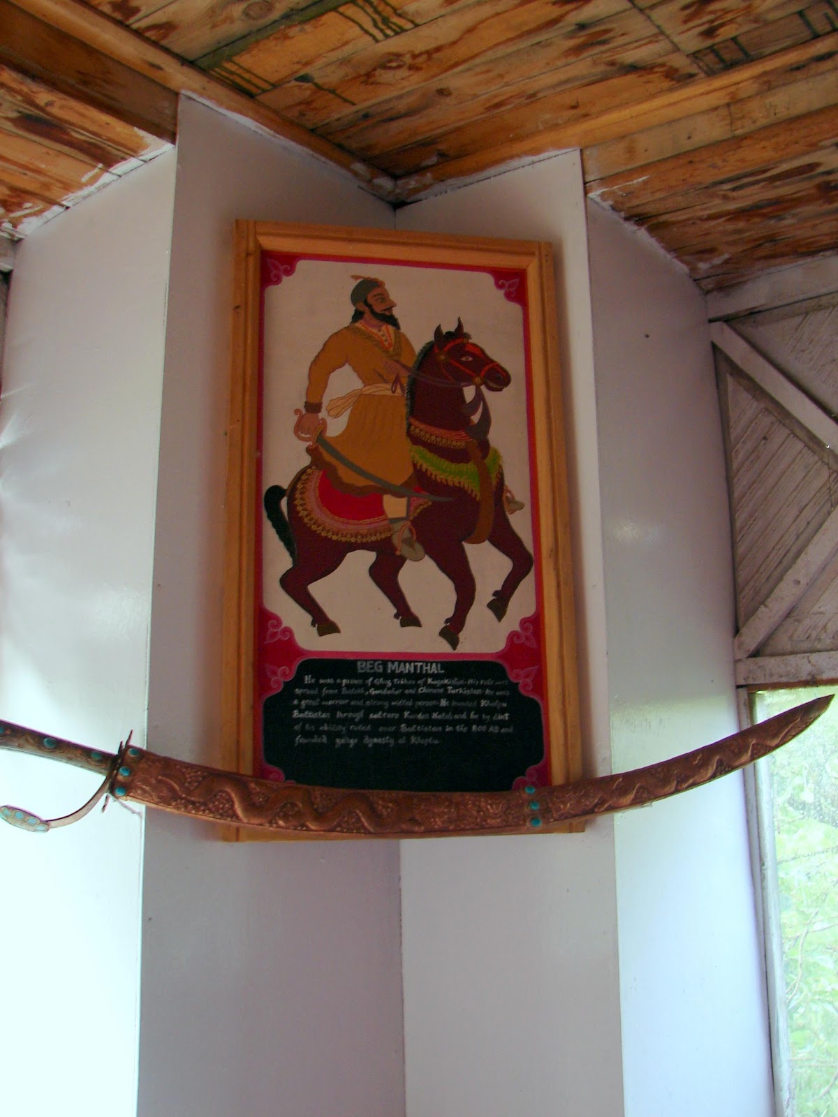
We were honored to meet the Khan of Turtuk, Mohammad Khan Kacho of the Yabgo Dynasty of Chorbat Khaplu. He is the direct descendant of King of Western Turkistan that ruled over this area (called Baltistan Chorbat) for over 1000 years (800AD – 1800BC). His ancestors derived their power and wealth from Turtuk’s strategic location on a feeder road of the Silk Route going on to Central Asia via Skardu and Yarkand. The old Khan now lives a poor life with a young wife and daughter aged 8-10 years who could be easily mistaken for his grand daughter.

Khan has his own private museum of family artefacts that have been passed on for generations. A proud historian himself he has written up the history of his village and compiled the family tree from a cloth version that was passed from generation to generation. A very humble and hospitable man, he warmly welcomes one and all to his humble abode and talks about his royal history with pride in fluent Hindi.


People of Turtuk primarily speak Urdu. Many can converse in Hindi and some Ladakhi. Most also have only a smattering of English.


Myriads of cobbled paths led us to a polo ground in Farol. Horse polo is the famous game of Baltis and is being played for centuries with gaiety and fervour. A game of Central Asian origin, it was first played in Persia (Iran) at dates given from the 6th century BC to the 1st century AD. Polo was at first a training game for cavalry units, usually the king’s guard or other elite troops. To the warlike tribesmen, who played it with as many as 100 to a side, it was a miniature battle.

In time polo became a Persian national sport played extensively by the nobility. Women as well as men played the game.From Persia the game spread to Arabia, then to Tibet (the English word polo is the Balti word meaning “ball”), to China, and to Japan.


Both parts of the village have a school that is managed by Avalokitesvara Trust.The trust’s vision is to empower children with the gift of education, the joy of learning, bringing previously absent opportunities for a better overall quality of life in the region.

The aim is to enhance the mental, emotional and psychological development of children within and beyond the education they receive at school, giving them the best possible foundation for the rest of their lives.


A land that is not frequented by the tourists manages to cling on to its slowly dying Balti culture. A visit to this little village sure makes you feel like you are on top of the world!

21 April, 2013

Pangong Tso - Lukung Lake

Nestled between Zanskar in Jammu & Kashmir and Tibet at an altitude of 15,000 feet is the restricted area of Rupshu. Lying on an ancient nomad route, Rupshu has sweeping deserts separated by narrow ranges with lofty passes and is inhabited by nomadic people called Changpas. The lowest point is at 13,000 feet along the Indus River near the town of Chumtang. Rupshu has several large, crystalline lakes like Tso Moriri and Pangong framed in large basins between two ranges of Ladakh and Zanskar mountains.


Rupshu abounds in myth and legend. Some say that Jesus passed the lost years of his life in Hemis monastery. Lama Govinda received his second spiritual, mystical initiation while resting at Thak Thok monastery on the approach to the Chang La and gypsy Davy and Lady Ba camped for three weeks at various places along Pangong Lake in the early 1920s. Once, Lady Ba's horse, Tomar, disappeared with a herd of Kiang(Tibetian Wild Ass). The best Shikaris were sent to track him, and they did, across two ranges and a valley. On the third day, Tomar returned seven years younger.


Kashmir Himalayas are characterised by high snow covered peaks, deep valleys, interlocked spurs and high mountain passes. A bone rattling drive of 5 hours from Leh through dramatic mountain roads and mountain pass Chang-la leads to Pangong lake. Situated at an elevation of over 5270m, Chang-la is a high mountain pass in the Greater Himalayas. Being snow-covered, it remains closed during the winter season. The pass has a temple dedicated to Chang-la Baba after whom the pass has been named. Hundreds of bright Green, Red, Orange and Yellow prayer flags at the temple flutter in the wind showering the blessings of Chang-la baba on the tourists.


The icy wind, the lack of oxygen and heavy snowfall makes it difficult to be at chang-la for long. The road after Chang-la is extremely steep, leading to the small town of Tangtse. Breathtaking views of the uniquely textured mountains in this region and the plains stretched before them, the Intriguing views of barren mountains, fabulous marshlands and a rare village make the journey picturesque and offer a special treat for senses.


Passing through the quaint village you might chance upon a herd of dzomos. Tibetans, Mongolians, and other cultures use dzo and dzomos as pack animals in high mountain regions, much the same as pure bred yaks. A rarely used English term of yakow refers to a female hybrid of yak and domestic cattle, popularly known as dzomor or Zhom. Cultures living in high elevations, such as the Himalayas, rely on animals with the strength and physiological characteristics required to carry heavy loads for long, arduous journeys through rugged mountain conditions. Animals, therefore, must have the ability to breath the rarified air of high elevations, as well as the dexterity to navigate difficult mountain terrain. Compared to purebred yak, dzo are more agile, owing to their cow ancestry, but without the pulmonary challenges cattle suffer at high elevations.


In addition to being pack animals, herders also use dzo and dzomos for more traditional livestock purposes. Since dietary requirements of yaks, cattle, and hybrids are the same, upkeep for large herds is relatively simple and allows herders to maximize the usefulness of each animal. Milk and meat production from bovid hybrids is reportedly higher than purebred yaks. Meat, milk, and hides not only provide sustenance for herders and their families, but commodities for resale to others.


Popularly known as Moon land for its outlandish landscape of vast barren mountains, Ladakh has scant vegetation, and virtually no rainfall. Animals have to survive in freezing conditions. Despite the hostile conditions, some wildlife manages to survive. The plains are home to the Tibetan wild ass or kiang, wild horses (the ones from Zanskar are even better known), and marmots whose population outnumbers that of humans by a ratio of 1000:1! Wild horses grazing here ar the backdrop of picturesque hills make wonderful frames.


Although the once massive herds of speedy Kyang, the Tibetan wild Ass, are greatly depleted in Rupshu, the Marmot colonies have not visibly suffered from poaching. In Rupshu, as in the sweeping Deosai plains of Baltistan and parts of rugged Zanskar, the sizable, sleek Marmots, larger than the groundhogs they resemble, are the real denizens of this high mountain desert.


Marmots are generally large ground squirrels and tend to live in mountainous areas. They typically live in burrows (often within rockpiles, particularly in the case of the yellow-bellied marmot), and hibernate there through the winter. Most marmots are highly social and use loud whistles to communicate with one another, especially when alarmed. They mainly eat greens and many types of grasses, berries, lichens, mosses, roots and flowers.

Indeed, as Richelle Mead quotest in "The Indigo Spell" “Sometimes it's worth lingering on the journey for a while before getting to the destination.”


Pangong Tso lake is known for its calm, clear and unending expanse. The size of the lake is best inferred from the probable etymology of its name, Pangong, which means extensive concavity. It is 130 km long and 7 km wide.

It is the biggest lake in Asia with its area falling under both India and China. One third of it is in India and remaining in China. The lake was once divided between Ladakh and Tibet as early as 1684 under the Treaty of Tingmosgang signed between the king of Ladakh, Deldan Namgyal, and the Regent of Tibet. As of today it is shared by India and China.


The Line of Actual Control between Indian and China passes through this lake. The eastern end of the lake is in Tibet and the dispute-free area of the lake is the western end. At present, the lake is the point in India from where intrusions of China can be easily observed.


The mirror-calm water is cold, clear, and extremely salty, holding sufficient quantity of lime to form a calcareous deposit, which cements the pebbles together in patches of concrete on its bank. It is believed that there is a large amount of minerals in the basin of the lake, which result from the melting of the snow.


Pangong Tso is a clear symbol of nature’s craftsmanship. Its brackish water plays with sun light to produce different colour effects. The water sparkles in distinct shades of blue, green, purple, and violet, being transparent to a good depth.


The lake remains cut off from the rest of the Ladakh for about six months (winter months) as the road leading to lake across the Changla pass remains closed for more than six months. The lake remains frozen for more than three months from the last week of December to first week of April.


The stark beauty and serenity of the lake has been known to touch a tender chord in even the most hardened traveler. Pangong comes as a breathtaking relief in the parched landscape of Ladakh. The haunting play of light and shadow on the hills around the lake and the sun rays playing magic with the crystal clear water imparting colours from turquoise to azure to an amazing irridescent green creates a surreal effect.

Sitting on its sandy beach and listening to the accentuated cackling of the birds,
feeling the gentle waves caressing your feet, you can't help but hum..

Put on your slippers and sit by the fire
Youve reached your top and you just can't get any higher
Youre in your place and you know where you are
In your shangri-la
Sit back in your old rocking chair
You need not worry, you need not care
You can't go anywhere
Shangri-la, shangri-la, shangri-la, shangri-la, shangri-la, shangri-la


You will want to return to this slice of heaven in the mountains!


29 March, 2013

Lamayuru Monastery (bla ma gyung drung dgon pa)

Ancient legend says that at the time of Buddha Shakyamuni, the valley of Lamayuru used to be a clear lake. King of Nagas and his retinue inhabited the valley. Bodhisattva Madhyantaka predicted that the lake would eventually dry up and make way for the construction of a Buddhist monastery.

Mahasiddha Naropa,a 11th century Indian Buddhist scholar sat in meditation for many years in one of the caves in Lamayuru, which can still be seen in the Dukhang. A crack was formed in the hillside surrounding the lake through which the lake started draining. When the lake dried out, Naropa found a dead lion lying inside it. On the same spot, he constructed the first temple of the area, known as the Sengye Gang (Lion Mound).

Lamayuru gompa, with its medieval village seemingly growing out of the rocky hillside belongs to the red-hat sect of Buddhism.


Lamayuru is perhaps the oldest monastery in Ladakh, thought to be a site of pre Buddhism Shrine of the ancient Bön religion of Tibet. Historical accounts relate that in the 10th century the King of Ladakh ordered the building of Lamayuru and placed it under the supervision of Rinchen Zangbo. The original gompa was composed of five buildings although only the central one still stands. The 16th century, Ladakh's King Jamyang Namgyal was cured of leprosy by a lama from Tibet. In gratitude, the King gave the gompa to this lama and also bestowed other privileges - no taxes were collected and the area surrounding the gompa was declared a sanctuary where none could be arrested. For this reason, Ladakh's still refer to Lamayuru as Tharpa Ling, the "Place of Freedom".


In the past, the gompa housed up to 400 lamas, but presently lesser than 50 lamas live here, although about 150 lamas belong to the gompa. The other lamas stay and teach at Lamayuru's daughter gompas located in outlying villages. Twice a year, all the lamas gather for prayers, accompanied by three days of masked dancing.

17 February, 2013

Galdan Tashi Chhuling Gompa [Diskit Monastery]


Diskit Gompa has quite an interesting legend attached to it. It is believed that a Mongol demon once lived here and was considered to be a sworn enemy of Buddhism. He was annihilated near the monastery. However, even after his death, his body kept coming back to the monastery. It is said that even today the wrinkled head and hand of the demon lie inside a temple of the monastery, which is filled with fierce Gods and Goddesses.


The following paragraph is borrowed from 'Research on Ladakh Proceedings of the sixth International Colloquium on Ladakh Leh 1993'

There is very little information on the valley before the 14th C; but from the time of King Grags-pa-'bum-Ide (2440 - 1440 AD) there are various historical references. The King's ambitious brother Grags-pa-'bum is said to have paid a visit to Nubra in the hope of seizing power. A local ruler, Nyi-ma-grags-pa, reigned there at that time and it is said that he assisted a Gelugpa exponent, Shes-rab-bzang-po, who came from the Leh valley to Nubra, where he built the monastery of Diskit, and installed a statue of Tsong-kha-pa, the founder of Gelugpa sect. He also visited Charasa village near Tegar and installed another statue at the Dwensa temple.

The king Tshe-dbang-rnam-rgyal, who came to the throne in the middle of the 18th C, offered Diskit gompa to the Rinpoche of Thikse and this arrangement has persisted to this day.


106 feet statue of Jampa (Maitreya) Buddha is located on top of a hill below the monastery and faces the Shyok river towards Pakistan. It was built with three main intentions - protection of Diskit village, prevention of further war with Pakistan and to promote world peace.

According to the chairman of the committee, most of the money for the statue was collected by local donations. The head of Gelugpa, Ganden Thipa and Abbott of Rizu monastery, gave 8Kgs of Gold for its decoration.


Diskit Monastery also known as Deskit Gompa or Diskit Gompa belonging to the Gelugpa (Yellow Hat) sect of Tibetan Buddhism is the oldest and largest Buddhist monastery (gompa) in the Nubra Valley of Ladakh, northern India.


The Gompa is not in a satisfactory condition. In several portions inside the Dukhang, there are large cracks in the plaster due to water penetration. This has lead to the flaking off of beautiful wall painings. The wall paintings also appear faded because of soot deposits over them. The Gompa has not been maintained properly for a long time causing its gradual deterioration. The Gompa has been repaired recently, and as a result of which, some precious inscriptions have been lost.


Diskit monastery houses about 100 monks and runs a school for the Tibetan children in its precincts. The school has been upgraded recently to enable teaching of scientific subjects with support from the Lungta, a 'Tibet Support Group' (a Non Governmental Organization -NGO) who have created computer facilities in the school. Lungta has trained the monks of the monastery in computer skills and in the English language so that they could in turn teach the children of the school. Further additions to the school library in the form of dictionaries, encyclopaedias and English teaching materials are being provided.