Showing posts with label kerala. Show all posts

24 July, 2011

Edakkal caves - A window to Pre Historic age


Fred Fawcett was a Superintendent of Police who served British government in Kozhikode. He had gone to Wayanad on an invitation from Colin MacKinzie, a planter who wanted him to join him on a hunting expedition. The planter showed him rock engraving in a cave and some very old implements which were found in his estate in 1890. They were situated on the western side of Ambukuthimala hill twelve kilometres south-west of the town of Sultan’s Battery in the Wayanad District of Kerala on an ancient route connecting the high ranges of Mysore to the ports of Malabar.


The name Ambukuthimala is ascribed to the local legend which has it that the caves were formed by arrows fired by Lava and Kusha, the sons of Sri Rama, legendary hero of the Ramayana.Even today there are many who believe that Lord Rama killed Surpanakha, the sister of Ravana, in the narrow fissure at the southern end of the cave.

Fawcett first discovered its anthropological and historical importance. Like many other officers of the British government posted in India, he had a keen interest in places and structures that had strong links with the culture and history of indigenous people and took time off his official duties to write about them. Fawcett was quick to understand these were "pre-historic". On his next visit to the cave in 1894 and in 1895 he was able to throw more light on the importance of the cave and the drawings found there. These were the Eakkal caves containing the Neolithic petroglyphs (rock engravings) on the walls.


The ground elevation is about 1200 metres above the mean sea level. The peak at over 500 metres above the surrounding area is easily identifiable from a considerable distance. The cave is formed by a heavy boulder straddling a fissure in the rock and hence has been appropriately named as “Edakkal” - which literally means “a stone in between”.


Edakkal cave is not a cave in the real sense. It is a fissure made by a corner of rock splitting off from the main body due to some natural causes. The depth of both the cleft and the fissure is 30 ft. What makes it a cave to the ordinary observer is the fact that in the other portion of the large cleft, an enormous rock, weighing several tonns, has fallen forming a roof over a large part of it. The rock wall contains some interesting carvings, which represent human and animal figures and objects of human use and symbols. These carvings speak of a highly civilized people of pre-historic era and inspires the archaeologists and historians to rewrite the history of Wayanad and Kerala as a whole.


Inside, the cave is on two levels. The lower chamber measures about 18 feet long by 12 feet wide and 10 feet high and can be entered through an opening of 5 x 4 feet. A passage opposite the entrance leads upward to a small aperture in the roof through which one climbs up to the next storey whose interior is about 96 feet long, 22 feet wide,and 18 feet high. Light enters the cave through a big gap at the right-hand corner of the roof where the boulder does not touch the facing wall.


The rock engraving indicate clear remnants of Harappan culture links the Indus Valley civilisation with South India. “There had been indications of remnants akin to the Indus Valley civilisation in Karnataka and Tamil Nadu, but these new findings give credence to the fact that the Harappan civilisation had its presence in the region too and could trace the history of Kerala even beyond the Iron Age” - historian M R Raghava Varier. Later, Mr. Varier, along with noted history scholar Rajan Gurukkal carried out further studies, which testified that the caves had remnants upto the Iron Age.


Of the identified 429 signs, "a man with jar cup", a symbol unique to the Indus civilisation and other compound letters testified to remnants of the Harappan culture, spanning from 2300 BC to 1700 BC have been found in this cave. The ‘jar’ is more or less same as those in Indus ligature. But the human figure is a little different. Mr. Varier opines that the Edakkal engraving has retained its unique style as the engraver tried to attain a two-dimensional human figure.

Human figures are depicted on the Indus Valley seals as holding various objects such as bow, jar,stick etc. Scholars have identified in the corpus of Indus script nearly 430 ‘letters’ including basic and compound signs. While some signs are shared by other contemporary civilizations of the Old World, some combinations like the ‘man-with-the-jar’ are peculiar to Indus Valley objects


These symbols form part of compound letters similar to scripts and no concerted efforts appear to have been made in the past to decipher them, with a lone exception by Iravatham Mahadevan (a scholar on the Indus valley civilisation), who could gather valuable ideas from such letters. The discovery of the symbols are akin to that of the Harappan civilisation having predominantly Dravidian culture and testimony to the fact that cultural diffusion could take place. It is wrong to presume that the Indus culture disappeared into thin air,” Mr. Varier said.

The carvings in Edakkal have as much importance as the cave paintings unearthed as the prototypes of ancient world art in Africa and Australia. Edakkal has the prodigious history of more than 5000 - 7000 years. The figures of the warriors wielding bows and arrows bear a remarkable resemblance to the picture found on an earthen vessel discovered from Susa in Persia.

Lakkidi - gateway of Wayanad and around


The hill station of Lakkidi is the gateway to the Wayanad district of Kerala. Located at an altitude of 700 meters or 2297 feet above the sea level, Lakkidi is the highest location in the Wayanad district and lies above the Thamarassery Ghat pass.


The lush greenery of the hills, gorges and streams seen on both sides of the passage up the hill are sure to linger on our mind for a long time. On a clear day Lakkidi View Point offers spectacular views of the surrounding cliffs and valleys.


One of the highest locations in Wayanad, Lakkidi gets the highest average rainfall in Kerala. So streams, brooks, and waterfalls are a common sight around here. The rainfall at Lakkidi has also created a fresh water lake called Pokkot Lake in this area.

Pookot, a natural fresh water lake is located at 2,100 meters above sea level. The breathtakingly beautiful lake is surrounded by lush greenery all around. The pathway around the lake is lined by thick bushes and tall trees. One of the main tributaries of the Kabani River – the Panamaram rivulet originates from Pookot Lake and then tumbles down into Panamaram valley.The fresh-water aquarium at the lake is filled with an excellent array of fish.

Mountains, streams, thick forest and the panoramic view of the valley are exciting images. It is one of the vantage locations to experience the magic and mood of the monsoon in the woods.


Kanthapara and Meenmutty go through an exciting journey before tumbling down from rocky massifs. The streams meander through dense greenery, emerging for a brief, glittering plunge through the air before disappearing once again under thick foliage cover.Though relatively smaller, Kanthanpara - a two tiered falls is easily reachable, and makes an ideal picnic spot.


Meenmutty is the biggest of the waterfalls in Wayanad district both in terms of volume and height. The water cascades down in three stages from a height of about 300meters. Located in lush moist deciduous forests, the waterfall is a trekker's paradise. The best time to visit the falls is between November and May because the water is too torrential during the post-monsoon months. Meenmutty in Malayalam means "where fish are blocked". Since there is upward falls where fish can’t swim further this name is given to the falls.

The Meenmutty, Soochipara, and Kanthanpara waterfalls combined, feed the Chaliyar river.


Apart from the stunning views of the surrounding plains, Lakkidi's other claim to fame is the large Ficus tree bound by a prominent chain. It is the source of a dramatic local legend. Tribal legend has it that Karinthandan was murdered by some British engineers after he showed them the tribal people's traditional pathway for the construction of a ghat road that links Wayanad and Kozhikode. But Karinthandan's ghost made life miserable for British people who travelled on the route. Finally, a Christian clergyman chained the ghost to a tree near Lakkidi to facilitate a trouble-free journey for the British. A heavy chain anchored to the ground and placed around the stout branches seems to lend credence to the story.

26 June, 2011

Sultan Batheri (Battery) Wayanad

The present Wayanad district came into being on 1st November 1980 comprising of three taluks viz. Vythiri, Mananthavady and Sultan Batheri.

Sultan Battery was part of Kidanganadu Village, which got its name because of the presence of Kidangans (tribes). It is also believed that this town was earlier known as "Ganapathivattom" - 'the fields of Ganapathi', owing to the Ganapati Temple situated in the heart of the town. Sultan Bathery derives its present name from Tipu Sultan of Mysore who used the abandoned Jain temple here and used it as his battery - hence the name Sultan's Battery.


The Jain Temple at Sulthan Bathery is believed to have been built during the 13th century. Its design is strongly influenced by the architectural style of the then reigning Vijayanagar Dynasty. At one point in history, this temple also served as the ammunition store or battery of Tipu Sulthan’s army.


Following text has been borrowed from the board displayed by ASI in the temple premises:
Kerala has a few jain monuments of historical and archaeological importance belonging from the 9th - 15th C of the Christian era. Jainism received the patronage of the Chera kings of Mahodayapuram and Ay kings of South India. However, these Jain centres declined after teh 11th - 12th C.


Local tradition states that there were 12 Jain streets in and around Sultan Battery. The Hanneradu bidi (Kannada words for 12 streets) is one among the traditional Jain settlements in Sultan Battery.

Sultan Battery was known as Ganpathi Vatam in inscriptions. The Jain temple is datable to the 14th C A.D. on stylistic grounds. Thsi is an example of the cloistered temple and is wholly built out of granite. Axially teh temple consits of a garbhariha, antarala , closed mahamandapa of Kerala tradition.

The sanctum is square shaped, devoid of any image, but the lalata bimba of garbhariha and clsoed Mahamandapa has sacred Jain images. These are shown in a square outline as in padmasana with dhyana mudra. The pedestal of the image has a lotus depiction. The door jambs are decorated with different motifs or sakhas. The base portion of door is having intricate floral motifs. The sanctum is having a pillared circumambulatory pathway.


The Mahamandapa followed by a Mukhamandapa is accessed through a flight of steps. Its balustrade is decorated with yali motifs. The Mukhamandapa stands on moulded adhisthana consisting of upana, jagathi, padma, tripatta kumuda, gala and patti. The pillars are of higly evolved type and deocrated with various designs such as floral motifs, sarpabanda (entwined serpents), garland decorations, stylised vajra, thirthankara, goose etc.


The detached Namaskara mandapa is supported on four pillars. Its roof is now missing. The temple originally had a cloistered wall which is now in ruins.


In ancient times the land was ruled by the’ Vedas’ Rajas. Later this land came under the rule of Pazhassi Rajah of Kottayam Royal Dynasty. Though Mysore ruler Hider Ali invaded Wayanad he brought it under his sway. In the days of Tippu Sultan it was restored to the Kottayam Royal Dynasty.

In the 18th Century, Tipu Sultan built a fort here in the heart of wayanad coffee and cardamom growing region, but not much of it remains. Though the fort does not remain any more, the place is worth the visit for the famous Jain Temple.

As per the Sreerangapatanam truce Tippu handed over the entire Malabar region to the British. This was followed by fierce encounter between the British and Kerala Varma Pazhassi Raja. With the help of ‘Kurichya’ tribal, Pazhassi organized guerilla type encounters with the British. In the end Pazhassi Raja killed himself and Wayanad fell into the hand of British.

The British rule made a new turn in the history of Wayanad. The British authorities opened up this land for cultivation of tea and other cash crops. They laid roads across the dangerous slopes of Wayanad from Calicut and Thallessery. These roads are extended to Mysore and Ootty through Gudallur.

Wayanad is backward in the case of Industries. There are no such major industrial units except tea processing factories, timber mills, and rice mills. In Sultan bathery, a mini industrial estate having 14 sheds is functioning under the control of SIDCO. A raw material unit is also operating there.

27 April, 2011

Check-post and Sri Rama Seetha Temple, Ponkuzhy, Wayanad


At the check-post


Ponkuzhi is fast developing into a pilgrim centre and halt for travellers as the inter-State highway NH 212 cuts through the muthanga forest. The perennial Noolpuzha running through this corridor is the only source of water for a large population of elephants moving through this area for three to four months a year.

Hundreds of vehicles speed through the highway linking Bangalore with Kozhikode. Vehicles, especially goods-laden lorries, have to halt at four check-posts located close to Muthanga and similar check posts on the Karnataka side also.


At the check-post


The following text has been borrowed from http://www.thepetitionsite.com/1/save-the-kerala-rainforest-elephants/

2.5 kilometer wide corridor that connects the two Indian states of Kerala and Karnataka (located in the Western Ghats mountain range) is also the last unbroken forest leading the largest population of Asian elephants from wet season to dry season feeding grounds. This incredibly environmentally-sensitive corridor has become the scene of development which threatens an entire herd. The corridor is so sensitive it has become part of an international campaign to change the location of the development so it will not have such a harsh impact on the elephants.

The area is also one of the world's ten "Hottest biodiversity hotspots" and has over 5000 species of flowering plants, 139 mammal species, 508 bird species and 179 amphibian species. At least 325 globally threatened species occur in the Western Ghats.

Presently, a busy interstate highway passes through the forest with checkpoints leading from one state to another in three places. This leaves the forest corridor free for the elephants. Unfortunately, and shortsightedly, the Indian government has decided to combine the checkpoints in the centre of the elephants corridor.

This development would include all manner of infrastructure - building complexes, housing, offices, toilets and dormitories for drivers, a fuel filling station and so on, writes the nonprofit conservation group, Rainforest Information Centre. The checkpoint clearance takes hours, so there would be hundreds of lorries (trucks) parked along the road throughout the night on either side of the checkpoints within the forests preventing elephants from using the corridor.

The Rainforest Information Center tells us that work is already in progress and a trench has been dug which prevents elephants from crossing the road, cutting [the elephants] off from the river and whatever little fodder available on the river margin.

The best solution would be the relocation of the checking stations to outside the forest on the Kerala side of the corridor where suitable land for this is available, suggests Rainforest Information Centre. It is also necessary to prohibit vehicle movement during certain night-time hours for example, between 11 p.m. and 4 a.m.

John Seed of Rainforest Information Centre told Monagabay.com: "we feel confident that international attention can persuade the Kerala government to move the site of its planned development out of the corridor and out of the jungle."

The Rainforest Information Centre is working with the Indian environmental organization, Wayanard Nature Protection Group, and an online activist center. They encourage concerned persons to write to the governments of the states involved hoping that international attention and pressure will cause a change in the development plans


Very close to the checkpost is the Sri Rama Seetha Temple at Ponkuzhy


Rama or Ramachandra is the seventh avatar of Vishnu in Hinduism,and a legendary king of Ayodhya in ancient Indian Puranas. Based on Puranic genealogy, Rama is believed to have lived during 1450 BC, during the Rig Vedic period.


The srirama temple at Ponkuzhi on the Sulthan Battery Mysore road bears testimony about the story of Ramayana. There is a natural pond near the temple, surrounded by bamboo forest. It is believed that the water in the pond is the result of the falling tears from the eyes of Rama's wife seetha.

26 April, 2011

Karapuzha Earth Dam at Vazhavatta in Vythiri


Kabini river is formed by the confluence of Mananthavady and Panamaram rivers. Other tributaries namely: Bhavanipuzha, Karapuzha and Narasipuzha originate in the western ghats and flow through Kerala State.

NEED TO USE CAUVERY WATER
Agriculture is the basic occupation of the people in the Kabini, the Bhavani and the Pambar Basins. The main crop in the low elevation is paddy where as in the middle and higher elevations it is the plantation crops. In the absence of assured water supply from irrigation projects, excepting a few minor irrigation works here and there serving limited ayacut, the agricultural crops in Cauvery basin in Kerala are dependent on the seasonal rainfall. Prior to the integration of States in 1956, Madras State to which Malabar belonged neglected the development of Malabar area and took no interest in the exploitation of Cauvery water for the development of irrigation or power in the Malabar region. After Malabar came over to Kerala, 9schemes were submitted by the State to Government of India for approval, for the development of irrigation in the two Cauvery Basins in Malabar. Excepting one project viz.Karapuzha in Kabini basin, no other scheme was approved by Government of India, obviously because the dispute on sharing of water was pending.

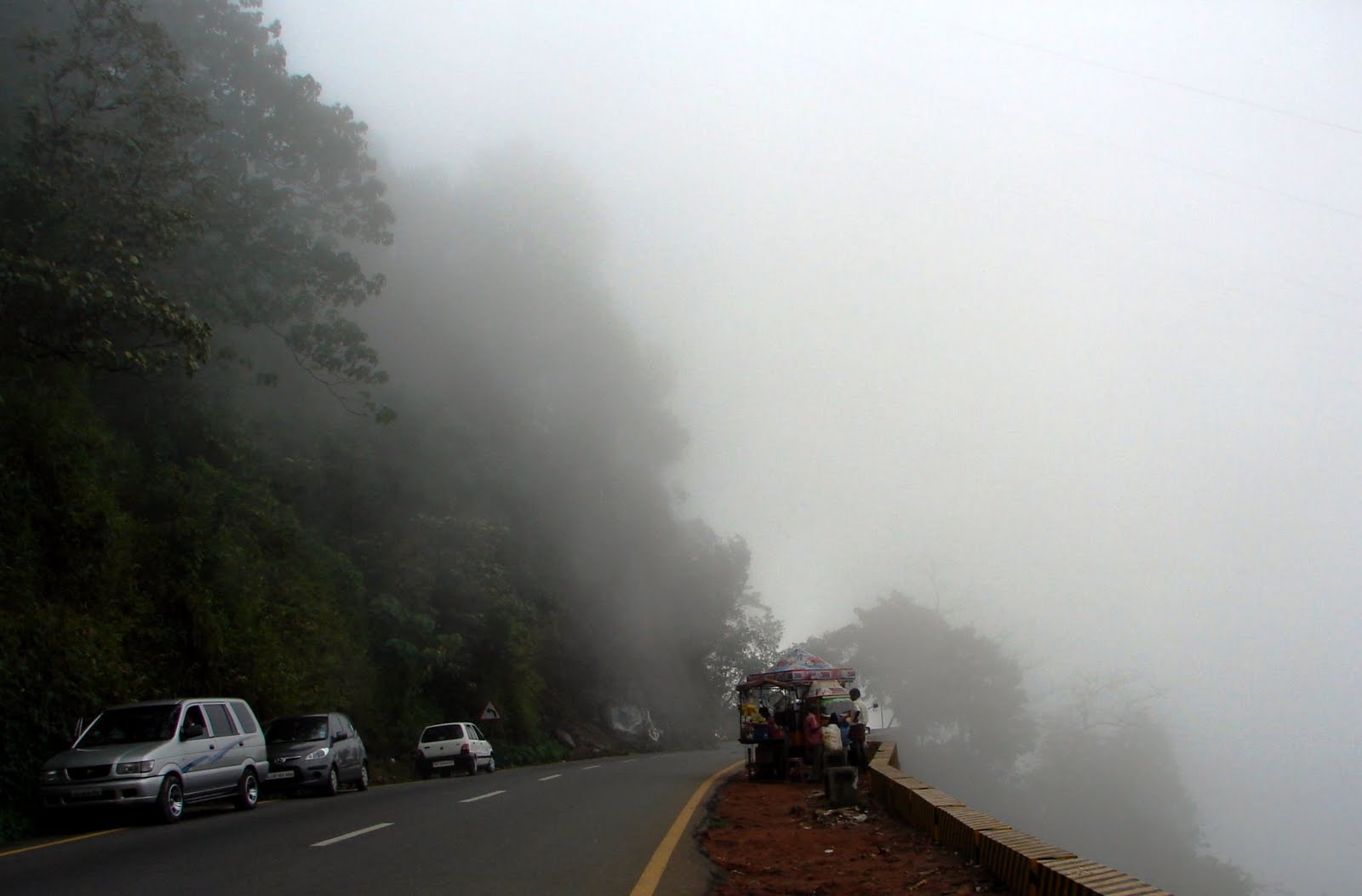
Karapuzha Irrigation project was the first scheme of Kerala approved by the Govt. of India in April, 1978 which they have since completed. The scheme was to construct an Earthen Dam across Karapuzha at Vazhavatta with a stroage reservoir and canal systems to irrigate 5,221 hectares of land in nine panchayat areas of three taluks in Wayanad district. The financial benefits from the cultivation of land in many parts of the world are rarely large enough to allow for expensive, technologically advanced concrete structures to be built for impounding water, whether on- or off-stream, and the alternative is normally an earth dam or simple weir.

Embankment dams have many advantages over equivalent concrete structures and are most appropriate for farm or other rural situations. Dams up to 15 m high, when built on suitable sites and correctly designed and constructed using good earthworks materials, can be built using relatively unsophisticated design procedures and equipment. Farm tractors (equipped with dam scoops, scrapers and rollers) are usually adequate for the construction of such an earth dam which, once completed, should generally have cost less than a concrete wall, with its attendant complex design and construction procedures.


Smaller earth dams require minimal maintenance (unless in difficult locations or in extraordinary climatic situations), and are better able to withstand foundation and abutment movements than the more rigid concrete and masonry structures.

Further advantage can be gained by constructing the embankment from material excavated from the reservoir area. This provides a small increase in storage capacity and reduces costs.

The original estimate of the project was Rs.7.60 crores for the completion of the project. Revised estimate for the completion of the dam was Rs. 429 crore.The project was assisted under the RID Fund of NABARD for speedy completion during the Ninth plan period.

But the project could not be completed as scheduled. Construction of the dam and 80% of works in the main canal were completed. The distributories are only in the investigation stage. During Tenth Plan it was proposed to complete the project by completing the essential items of works which would optimise the benefit of the infrastructure already created within a period of two years in a phased manner. It was proposed to complete the remaining works in the dam and main canal during the first year and the remaining works in the branches and finishing works for commissioning during the second year.

Though the construction work of the right and left bank channels had been completed in 2009, five breaches occurred during the monsoon season. Thus, the full potential of the dam cannot be used for irrigation purposes. However, 12 km of these channels will have the potential to irrigate as much as 300 hectares of land at the time of partial commissioning.


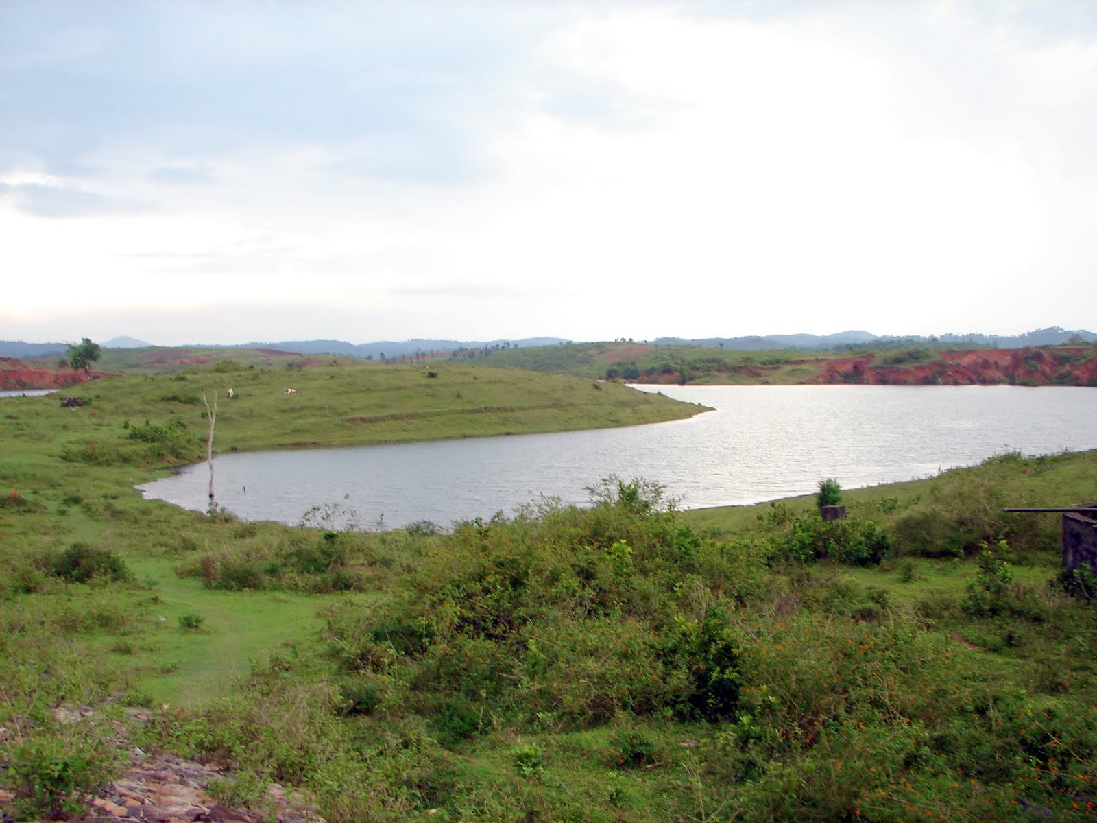
Though the total water storage capacity of the dam is 76.5 million cubic metres, the water would be stored only at half the capacity as many parts of the water belt areas of the reservoir would be submerged in water where the land acquisition procedures are yet to be completed.

1,238 hectares of 1,250 hectares of land have been acquired for the reservoir and 126hectares of land for the construction of channels. A drinking water project under the Kerala Water Authority is nearing completion to supply 15 million litres of water from the reservoir in the Kalpetta municipality and the Meenangadi and Ambalavayal panchayats.


It is worthwhile to mention the reasons given regarding necessity of the scheme as follows:-

Agriculture has to be developed as the only source of existence of the local people. At present, generally, only one crop of paddy is cultivated. This is mainly because, rainfall is available only for one crop and the duration of the crop is very long. Hence the agricultural labourers get employment for a short period in one year and they get no employment during other periods. By adopting new high yielding varieties of paddy, it is possible to raise two crops of paddy easily. But this new pattern requires irrigation during the early parts of the first crop i.e. during May-June and also during the second crop period. The aim of the project is to provide this irrigation facility. This will increase the employment potential considerably.

The land owners are also benefited as the production of rice increased considerably.

The development of infrastructure such as construction of new roads, bridges, buildings etc. will open out new fields of activities which will help developing the area considerably.

This project was technically examined in Central Water Commission before it was given investment clearance by the Planning Commission, Govt. of India.

The extract from Govt. of India’s letter of 19th April, 1978 approving Karapuzha project is reproduced below:-

1) The acceptance of this project in the Cauvery basin is further subject to the Inter-State understanding of August 1976 regarding utilization of Cauvery waters and the utilisation from the above project shall not exceed 2.80 TMC.” (Ref:KL Vol. 3, Exh. 29)

2) Although in the Statement of Case and the affidavits of the witnesses, the State has been emphasizing on spice and plantation crops but while placing the demand for water, they have only submitted their requirement for mainly paddy and vegetable crop
besides indicating demand for domestic and industrial uses. Also, there are some hydro-power projects which involve inter-basin transfer of water. It would be interesting to refer to Kerala’s Statement of Case reproduced below:-
“Development of agriculture, particularly plantation crops which give large scale employment, is a worthwhile economic activity that can be taken up in the Cauvery basin region, and adjoining areas, in order to improve the economic conditions of the
people there. Plantation crops like coffee, cardamom, arecanut, coco and pepper require water throughout the year, particularly during the summer months, and are very sensitive to drought. Unlike seasonal crops, once the plantation crops are affected by drought it require about five years or more to raise new crops and bring them to yielding stage. Water resources can be exploited for maximum production when applied to plantation crops since the economic benefit per unit of water from plantation crops is much more.”

It appears that though plantation crops require water throughout the year, requirement is critical particularly during the summer months, as the plantation crops are said to be very sensitive to drought. It appears that for the spice and garden crops normally their water requirement is met with from the rain water except in some cases of short fall during summer months and once the projects are in position, the small requirement of plantation crops could be met with from the reservoir storages for which provision of 5% of the irrigation requirement in reservoir projects has been made as a safeguard to meet emergency requirements of plantation crops as and when necessary.

3) As regards culturable command area (CCA) and ayacut under individual projects, it is noticed that invariably the extent of proposed ayacut is much less than the CCA. This appears to be so, because of the physical nature of the area which is undulating in character.

The State has reported that the main crop in the low elevation areas is paddy, whereas in the middle and higher elevations, it is the plantation crops. Taking this situation in consideration, attempt has been made to assess reasonable needs of the State so that irrigated area equal to the culturable commanded area could be allowed.

4) The State has proposed two paddy crops and one vegetable crop for the Kabini sub-basin. However, it is seen that in case of first crop “Virippu” which is raised during May to September, bulk of its water requirement is met with from south-west monsoon precipitation. This is mostly a rainfed crop.
The second crop “Mundakan” is raised from end of September to end of January i.e. the winter season when some rainfall from northeast monsoon provides support. This is their principal irrigated paddy crop.
The third crop “Puncha” is grown from January end to early May mainly as a summer crop. Although, the State Govt. has proposed raising first crop i.e. Virippu and summer paddy crop i.e. Puncha, but summer paddy cannot be allowed because of non-availability of rainfall support. The first crop needs little support of artificial irrigation. The second crop namely: Mundakan which succeeds Virippu as a
transplanted crop, this needs artificial irrigation although it receives some support from northeast monsoon.
The Govt. of India while sanctioning Karapuzha project has also allowed these two paddy crops with a water delta of 1.38 ft. and 4.38 ft. As regards the summer season, it is suggested that vegetable crop which the State proposes to raise during the winter season could be shifted to the summer season and grown in patches where residual moisture from the previous paddy crop is available and if needs further support that could be taken from ground water.

This approved project covers a CCA of 13,800 acres with an ayacut of 11,500 acres. The proposed net irrigation covers the entire ayacut of 11,500 acres. The approved project allows two paddy crops namely; khariff paddy (Virippu-period May to September) in 11,500 acres and second crop of rabi paddy (Mundakan-period October to February) in the same area i.e. 11,500 acres (total 23,000 acres – gross irrigation). This gives an intensity of irrigation as 166% when compared to CCA. The water requirement under this project including lake losses has been limited to 2.8 TMC as provided in the clearance letter. (Ref. KL Vol. 3, Exh. No.29 front page – letter of acceptance dated 19.4.78)


The examination of the remaining nine projects shows that the season of first paddy crop (i.e. Virippu) as mentioned in the project reports (submitted before the Tribunal) has been delayed by two months i.e. instead of crop period being from May to September, it has been shown as July to November. Similarly, the second crop of paddy (i.e. Mundakan) is proposed to be taken in the summer season from February to May and during the intervening period between November and February which is
normally Mundakan season, they are proposing to raise vegetable crops.

As is well known, raising of paddy crop during summer season consumes lot of water and is also without any support from rainfall, as such, there have been recommendations of the National Commission of Agriculture, 1976 as well as the Irrigation Commission, 1972 that paddy crop should not be raised during summer season, when there is no support from rainfall. Also by projecting three crops as mentioned above in their projects in the Kabini sub-basin, the State of Kerala has indicated a very ambitious plan.

Keeping in view the fact, that the hilly region of Kabini sub-basin is inhabited by substantial tribal population and has so far been underdeveloped, being without any reasonable irrigation facilities, it seems worthwhile to allow two paddy crops namely: Virippu and Mundakan as already approved by the Govt. of India in the case of Karapuzha project.

This also appears to be justified because during the south-west monsoon season from May to September when Virippu crop is raised, there is very good support from the rainfall and only minimum support from artificial irrigation is needed, which is limited to 1.38 feet of delta (water depth). But in the Mundakan season i.e. from October to February, when second paddy crop is raised, as already permitted by the Government of India in the Karapuzha project, support from irrigation is required which would be of the order of 4.38 feet delta.

As regards the vegetable crop which the State has proposed as a third crop, the same could be taken in those valley areas where there is residual soil moisture supported by ground water exploitation.